Drones in monitoring deforestation and biodiversity
Drones in monitoring deforestation and biodiversity significantly enhance conservation efforts by providing real-time data, minimizing wildlife disturbance, and enabling access to remote areas for comprehensive ecosystem analysis.
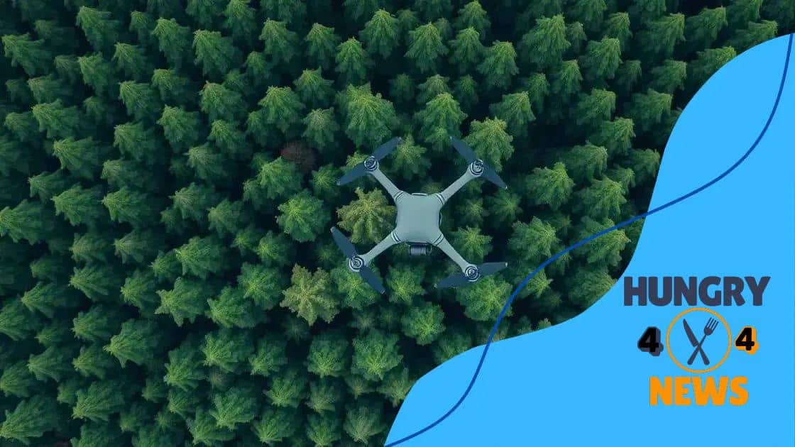
Drones in monitoring deforestation and biodiversity are changing the way we understand our ecosystems. Have you ever thought about how these tools can help us protect our natural world? Let’s dive into this fascinating topic!
How drones are used in deforestation monitoring
Drones are playing a vital role in monitoring deforestation. Their ability to capture high-resolution images from above helps researchers gather crucial data about forest health and changes over time. This technology allows for real-time updates, empowering conservation efforts.
Applications of Drones in Deforestation Monitoring
Various applications use drones to detect deforestation and its impact:
- Mapping forest cover changes over time
- Identifying illegal logging activities
- Monitoring reforestation projects
- Assessing habitat loss for wildlife
The use of drones is not just about seeing the big picture; they can also provide detailed insights into forest ecosystems. With tools like multispectral cameras, drones can analyze vegetation health by capturing light reflectance data.
Advantages of Using Drones
Using drones in forest monitoring comes with numerous advantages. For example, they are cost-effective and can cover large areas quickly. Drones reduce the need for human presence in sensitive areas, minimizing environmental impact. Additionally, they make it easier to access hard-to-reach locations, allowing researchers to gather data safely.
Furthermore, data collected from drones can be processed using advanced software to create detailed maps. These maps help in understanding the extent of deforestation and planning effective restoration strategies. As technology improves, the potential of drones in this field continues to grow, offering new opportunities for conservationists.
Monitoring deforestation with drones enables timely interventions. The faster we detect changes, the quicker we can respond to threats. This proactive approach is essential in combating biodiversity loss, making drones a crucial tool in environmental conservation efforts.
Benefits of drones for biodiversity assessment
Drones offer numerous benefits for biodiversity assessment. They provide researchers with the ability to gather vital data without disturbing sensitive environments. This innovative technology enhances our understanding of wildlife populations and their habitats.
Key Advantages of Using Drones
Here are some key advantages that drones bring to biodiversity assessment:
- Ability to reach remote or difficult locations
- Minimized disturbance to wildlife
- High-resolution imaging for detailed analysis
- Cost-effective alternative to traditional methods
With drones, researchers can conduct surveys more frequently and cover larger areas than they could on foot. This versatility allows for a more comprehensive understanding of species distribution and ecological changes. For example, drones can help monitor rare species, ensuring they are protected.
Monitoring Ecosystems and Habitats
In addition to monitoring wildlife, drones play a crucial role in assessing entire ecosystems. By collecting data on vegetation health, water quality, and soil conditions, researchers gain a clearer picture of the overall environment. Effective monitoring can help identify areas that are threatened or in need of restoration.
Furthermore, equipped with advanced sensors, drones can detect changes in biodiversity over time, which is essential for conservation efforts. Analyzing this data allows for timely interventions and strategy adjustments, addressing potential threats before they escalate.
Utilizing drones for biodiversity assessment promotes collaboration among conservationists, scientists, and policymakers. By sharing data collected through this technology, stakeholders can develop informed, evidence-based approaches to preserving our planet’s rich biodiversity.
Case studies: Successful drone initiatives

There are many successful drone initiatives around the world that showcase the impact of this technology on environmental conservation. These case studies provide valuable insights into how drones are transforming efforts to monitor and protect ecosystems.
Notable Examples of Drone Use
One excellent example is in Madagascar, where drones help track illegal logging and deforestation. Monitoring these activities allows local authorities to take prompt action in protecting vital rainforests. Another impressive initiative is in Costa Rica, where drones are used to monitor wildlife and assess habitat changes, aiding in the study of biodiversity in the region.
- Drones in Madagascar for tracking illegal logging
- Monitoring wildlife in Costa Rica
- Aerial surveys in the Amazon rainforest
- Drones for mapping wetlands in the United States
These projects highlight the versatility of drones. In addition to monitoring deforestation, they can also assist in mapping ecosystems. For example, a project in the Amazon rainforest employs drones to survey large areas without disturbing wildlife. The data collected helps conservationists understand how forest cover changes over time.
Impact on Conservation Strategies
Successful case studies reveal how data collected using drones informs conservation strategies. In South Africa, drones are used for anti-poaching efforts, significantly improving surveillance in vast areas. Maintaining a watchful eye on endangered species helps protect them from threats.
Moreover, these initiatives encourage collaboration among various stakeholders. With shared data, governments, NGOs, and communities can work together to create effective conservation policies. The success of these drone initiatives demonstrates the potential for combining technology with environmental stewardship, creating a hopeful path for the future.
Technological advancements in drone capabilities
Recent technological advancements in drone capabilities have transformed how they are used in various fields, especially in conservation. These improvements allow drones to gather more data more efficiently and accurately.
Enhanced Imaging Technologies
One significant development is in imaging technology. Drones now can carry high-resolution cameras and multispectral sensors. This allows researchers to capture detailed images of plant health and wildlife. With these tools, conservationists can assess ecosystems and monitor changes over time.
- High-definition cameras for better visuals
- Multispectral sensors for plant health assessment
- Infrared cameras for night operations
- LiDAR technology for precise mapping
Furthermore, advancements in battery life have extended the flight times of drones. This increase in duration enables them to cover larger areas without the need for frequent recharges. Longer flights lead to more data collection and thorough analysis of ecosystems.
Autonomous Flight and Navigation
Innovation in autonomous flight systems has made drones easier to operate. They can now navigate pre-defined routes by themselves, ensuring data accuracy while minimizing human intervention. The use of GPS and real-time tracking improves their efficiency in monitoring environmental changes.
Another exciting advancement is the integration of artificial intelligence. Drones equipped with AI can analyze data on-site, identifying patterns and anomalies in real-time. This capability helps conservationists to react quickly to threats, such as illegal logging or poaching activities.
As drone technology continues to evolve, new applications are emerging. For instance, drones are starting to be used in seed dispersal for reforestation projects. This method enhances restoration efforts and promotes biodiversity in affected areas.
Future trends in drone technology for conservation
The future of drone technology in conservation is incredibly promising, with exciting trends emerging that will enhance our ability to protect the environment. As technology advances, we are likely to see even more innovative uses for drones in monitoring and preserving biodiversity.
Integration with AI and Machine Learning
One significant trend is the increased integration of artificial intelligence and machine learning. Drones equipped with these technologies can analyze data on-the-fly, identifying critical changes in ecosystems. This capability helps conservationists make quicker, more informed decisions. For example, AI can assist in recognizing patterns related to wildlife movements or habitat changes.
- Automated data collection and analysis
- Real-time monitoring of environmental changes
- Enhanced predictive capabilities for conservation strategies
- Improved accuracy in species identification
Additionally, drones may become more autonomous, allowing them to conduct long-range surveys without constant supervision. This autonomy enables conservationists to gather data from hard-to-reach areas, ensuring comprehensive coverage of vulnerable ecosystems.
Advancements in Sensor Technology
As sensor technology continues to improve, drones will be able to collect even more detailed data. Future drones might employ advanced sensors to gather information on atmospheric conditions, soil moisture, and vegetation health. This data will provide a holistic view of ecosystem health, aiding in more effective conservation efforts.
Moreover, with the rise of swarm technology, multiple drones can operate together, sharing data and covering vast areas more efficiently. This collaborative approach allows for a significant increase in data collection and analysis, leading to more robust conservation strategies.
Future trends also point to drones playing a crucial role in community engagement. By enabling local communities to track and monitor their environments, drones can empower people to take part in conservation efforts. Collaborative data collection fosters a stronger connection between communities and their local ecosystems.
FAQ – Frequently Asked Questions about Drones in Conservation
How do drones help in monitoring biodiversity?
Drones can capture high-resolution images and data from the air, allowing researchers to monitor wildlife populations and their habitats effectively.
What are the main benefits of using drones for conservation?
Drones minimize disturbance to wildlife, cover large areas quickly, and provide real-time data, enhancing conservation efforts.
Can drones be used in remote areas?
Yes, drones are excellent for accessing hard-to-reach locations, enabling data collection in previously inaccessible ecosystems.
What technological advancements are improving drone capabilities?
Improvements in sensor technology, battery life, and AI integration are enhancing drones’ efficiency and effectiveness in conservation work.


